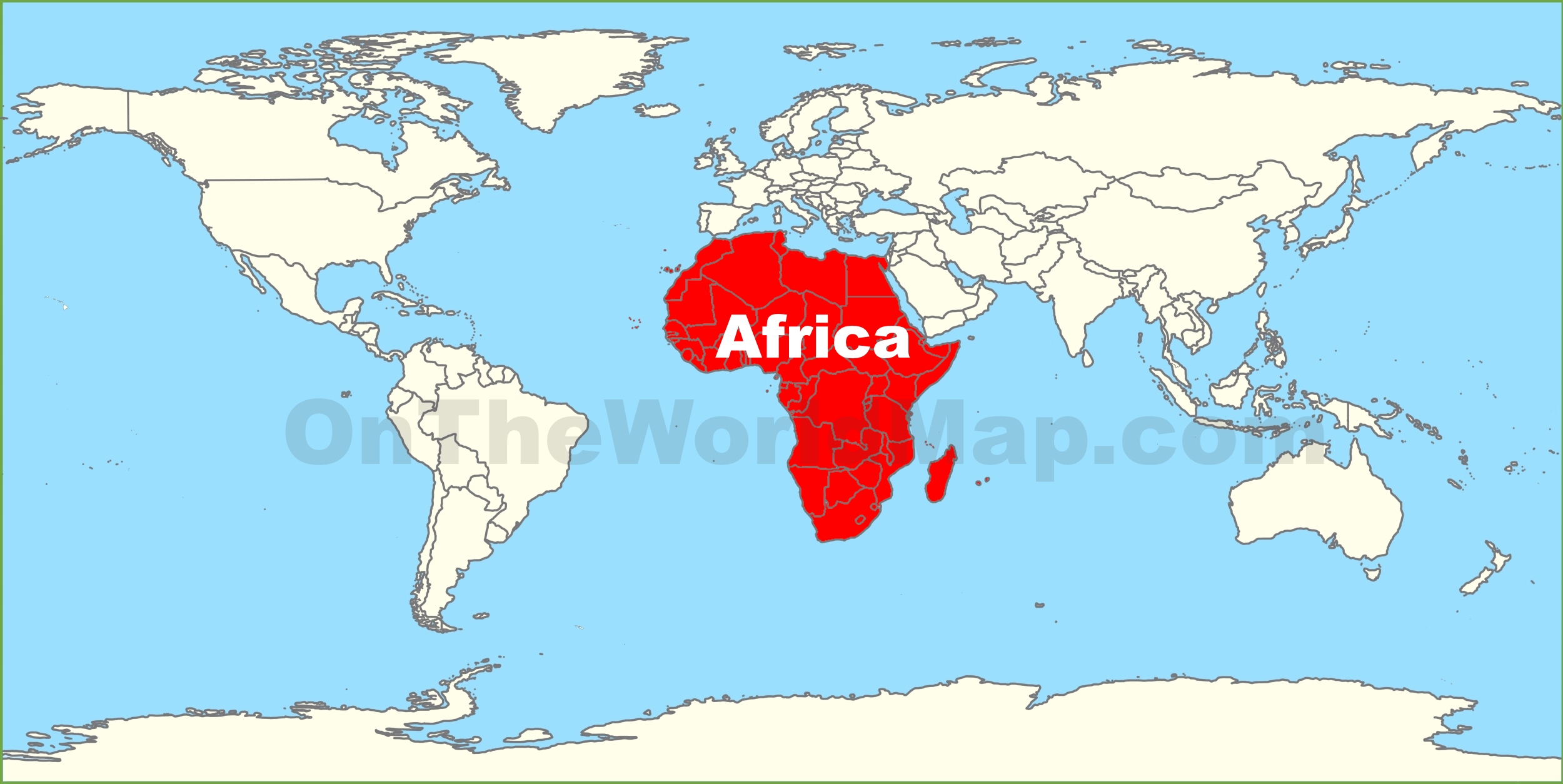

For 457 years, one map has shaped how generations of people around the world visualised the size of continents.
The Mercator projection, introduced in 1569, became one of the world’s most widely recognised maps. Originally designed primarily for navigation, its method of projecting the spherical Earth onto a flat surface makes landmasses closer to the poles appear significantly larger than they actually are.
The result? Greenland can appear comparable in size to Africa on some versions of the map, even though Africa is approximately 14 times larger.
But on September 4, 2026, the conversation about how the world is represented on maps took a new turn.
A United Nations resolution aimed at promoting a more accurate representation of continental landmasses was supported by 164 countries. The United States voted against it, while six countries abstained.
The development has triggered a much bigger conversation: Can changing the map change how the world sees Africa?
Also Read: AFRICA FUNDING G20
Africa Was Never Small
The physical size of Africa has not changed.
What has changed is the way that size can be visually represented.
The Equal Earth projection offers a more accurate comparison of continental areas, allowing viewers to better understand Africa’s actual geographical scale.
Africa covers more than 30 million square kilometres and is the world’s second-largest continent by both land area and population.
Yet, generations of students have grown up looking at maps where Africa appears visually smaller than it really is.
That difference may seem like a technical issue, but maps are not simply drawings.
They influence what people learn, what they imagine and how they understand the world.
More Than a Map
The debate surrounding the map has therefore moved beyond geography.
Supporters of efforts to promote more accurate maps argue that visual representation can influence perceptions of Africa’s importance, potential and place in the international system.
For young Africans especially, seeing the continent represented more accurately could provide a different understanding of its geographical scale.
Africa’s size is remarkable. Its landmass could accommodate the United States, China, India and several European countries combined.
Yet the continent is often discussed internationally through narratives of poverty, conflict and underdevelopment.
A more accurate map will not solve those challenges.
It will not create jobs, improve infrastructure or transform economies.
But it can challenge one particular misconception: the idea that Africa is somehow geographically small or marginal.
164 Countries Say Yes
The overwhelming support for the UN resolution has also introduced a geopolitical dimension to the debate.
With 164 countries voting in favour, the United States voting against and six countries abstaining, the outcome demonstrated broad international support for the proposal.
The disagreement also raises questions about how international institutions approach cartography and whether changing established representations should be considered a priority.
For Africa, however, the significance may lie beyond the vote itself.
It is an opportunity to ask why the continent has historically been represented in particular ways — and who gets to define the images through which the world understands Africa.
Can a Map Change a Mindset?
A map cannot change Africa’s economic or political reality.
But the images people repeatedly see can influence the assumptions they develop.
For generations, the Mercator projection has been used in classrooms, books, media and digital platforms around the world. Its distortions were never intended to diminish Africa; they were a consequence of the mathematical requirements of the projection.
Nevertheless, the visual effect remains.
Correcting the map therefore offers an opportunity to correct a perception.
And perhaps that is why the debate has resonated beyond geography.
It raises a larger question about representation: If Africa can challenge the way it is drawn on the map, what other misconceptions should it challenge?
Africa Must Also Represent Itself
The responsibility cannot rest entirely with international institutions.
African governments, educators, journalists, filmmakers, writers and media organisations also have a role to play in presenting a more complete picture of the continent.
Africa must tell its own stories — about its history, innovation, culture, cities, businesses, people and possibilities.
The continent should not only demand that the world see Africa accurately.
It must also ensure that Africa accurately represents itself.
The map may be changing, but the bigger challenge is changing the mindset surrounding it.
Africa was never small.
Its landmass has always been enormous. Its history has always been significant. Its people have always been diverse. And its potential has never been limited by the size assigned to it on a classroom wall.
The question now is not simply how big Africa is.
The question is: What will Africa do with the space, resources and potential it has always possessed?
The Hour Africa Got Its Dimension Back
For 457 years, one map has shaped how generations of people around the world visualised the size of continents.
The Mercator projection, introduced in 1569, became one of the world’s most widely recognised maps. Originally designed primarily for navigation, its method of projecting the spherical Earth onto a flat surface makes landmasses closer to the poles appear significantly larger than they actually are.
The result? Greenland can appear comparable in size to Africa on some versions of the map, even though Africa is approximately 14 times larger.
But on September 4, 2026, the conversation about how the world is represented on maps took a new turn.
A United Nations resolution aimed at promoting a more accurate representation of continental landmasses was supported by 164 countries. The United States voted against it, while six countries abstained.
The development has triggered a much bigger conversation: Can changing the map change how the world sees Africa?
Africa Was Never Small
The physical size of Africa has not changed.
What has changed is the way that size can be visually represented.
The Equal Earth projection offers a more accurate comparison of continental areas, allowing viewers to better understand Africa’s actual geographical scale.
Africa covers more than 30 million square kilometres and is the world’s second-largest continent by both land area and population.
Yet, generations of students have grown up looking at maps where Africa appears visually smaller than it really is.
That difference may seem like a technical issue, but maps are not simply drawings.
They influence what people learn, what they imagine and how they understand the world.
More Than a Map
The debate surrounding the map has therefore moved beyond geography.
Supporters of efforts to promote more accurate maps argue that visual representation can influence perceptions of Africa’s importance, potential and place in the international system.
For young Africans especially, seeing the continent represented more accurately could provide a different understanding of its geographical scale.
Africa’s size is remarkable. Its landmass could accommodate the United States, China, India and several European countries combined.
Yet the continent is often discussed internationally through narratives of poverty, conflict and underdevelopment.
A more accurate map will not solve those challenges.
It will not create jobs, improve infrastructure or transform economies.
But it can challenge one particular misconception: the idea that Africa is somehow geographically small or marginal.
164 Countries Say Yes
The overwhelming support for the UN resolution has also introduced a geopolitical dimension to the debate.
With 164 countries voting in favour, the United States voting against and six countries abstaining, the outcome demonstrated broad international support for the proposal.
The disagreement also raises questions about how international institutions approach cartography and whether changing established representations should be considered a priority.
For Africa, however, the significance may lie beyond the vote itself.
It is an opportunity to ask why the continent has historically been represented in particular ways — and who gets to define the images through which the world understands Africa.
Can a Map Change a Mindset?
A map cannot change Africa’s economic or political reality.
But the images people repeatedly see can influence the assumptions they develop.
For generations, the Mercator projection has been used in classrooms, books, media and digital platforms around the world. Its distortions were never intended to diminish Africa; they were a consequence of the mathematical requirements of the projection.
Nevertheless, the visual effect remains.
Correcting the map therefore offers an opportunity to correct a perception.
And perhaps that is why the debate has resonated beyond geography.
It raises a larger question about representation: If Africa can challenge the way it is drawn on the map, what other misconceptions should it challenge?
Africa Must Also Represent Itself
The responsibility cannot rest entirely with international institutions.
African governments, educators, journalists, filmmakers, writers and media organisations also have a role to play in presenting a more complete picture of the continent.
Africa must tell its own stories — about its history, innovation, culture, cities, businesses, people and possibilities.
The continent should not only demand that the world see Africa accurately.
It must also ensure that Africa accurately represents itself.
The map may be changing, but the bigger challenge is changing the mindset surrounding it.
Africa was never small.
Its landmass has always been enormous. Its history has always been significant. Its people have always been diverse. And its potential has never been limited by the size assigned to it on a classroom wall.
The question now is not simply how big Africa is.
The question is: What will Africa do with the space, resources and potential it has always possessed?
Discover more from LN247
Subscribe to get the latest posts sent to your email.